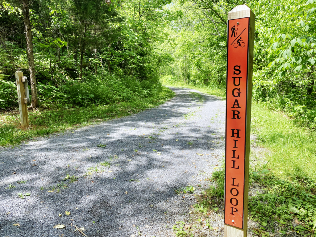
Sugar Hill Loop Trail, a moderate trail that offers panoramic views, history, wildlife encounters and glimpses of the Clinch River, is a true gem of a hiking experience, especially for those with young families or fur-babies. At around the halfway point of this scenic loop trail, you’ll have an opportunity to explore the ruins of an 18th Century French settlement. This trail’s distance and occasional inclines might be somewhat challenging for novices, but it’s on the low end of the moderate scale and welcoming to just about any conditioning level. Parking capacity at the trail head is generous (12-15 vehicles). While there are no restrooms at the trail head, a single toilet is available at the settlement site. The trail is located inside Clinch River State Park and is maintained by the Virginia Department of Conservation and Recreation. The trail head is located in the Town of St. Paul, VA.
| Type | Difficulty | Distance | Time | Max Altitude | Altitude Gain | |
| Loop | Moderate | 3.6 miles | 95 minutes | 1,815 | 371 |
Trail Head Coordinates: 36°54’03.6″N 82°19’05.9″W
Historical Settlement Coordinates: 36°53’59.9″N 82°19’14.4″W
GIS Mapping Files: CSV GPX KMZ
What to Expect
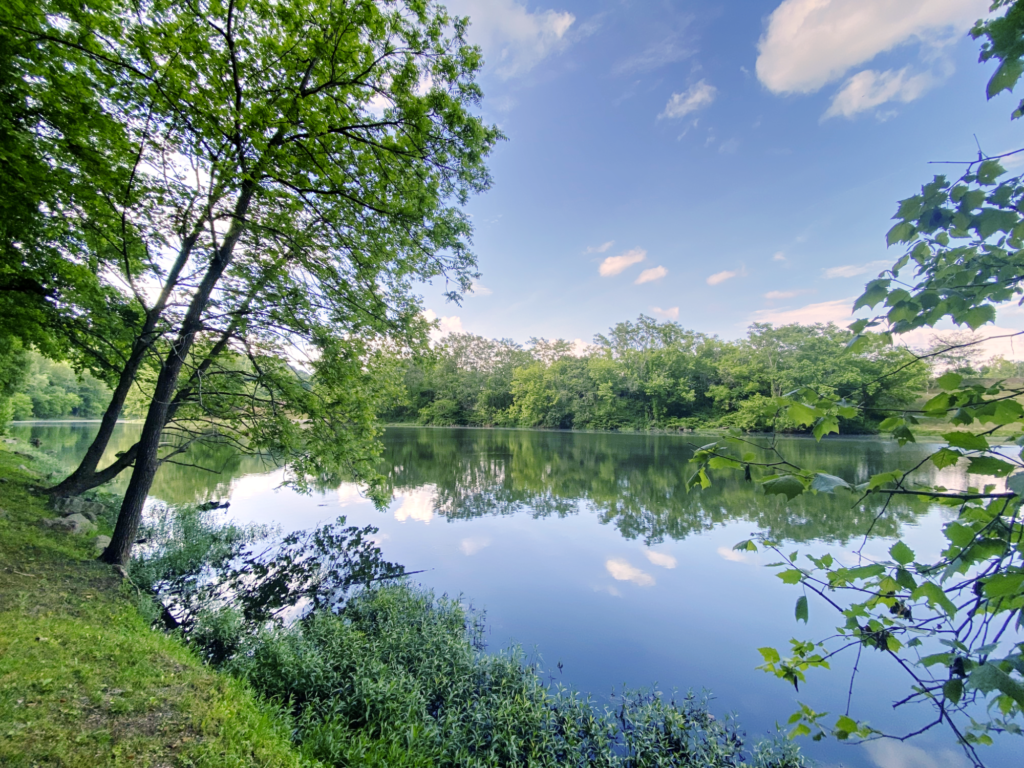
From the trail head, follow signs across a walk path that gives you a nice head-on view of the Clinch River. The riverbank here is often kept company by local fishermen, so take the opportunity to watch a few smallmouth bass being reeled in if you need to stop and tie a shoelace before heading out. After you cross the walk path, you’ll be greeted by a state park kiosk with information relevant to your hike and the park. The Clinch River is one of the most biodiverse bodies of water in the United States and is home to rare and endangered varieties of mussels and more species of fish than any river in Virginia.
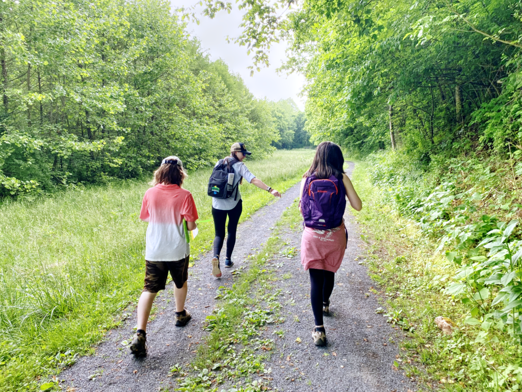
At the kiosk, you’ll have the option of beginning the loop clockwise along a gravel and grass roadbed path, which parallels the river on the left, or counterclockwise, heading immediately uphill on the right. We chose to begin clockwise on the gravel path, and later applauded ourselves for doing so! Completing the loop counterclockwise will result in a much more challenging hike, as the incline in that direction is considerably steeper.
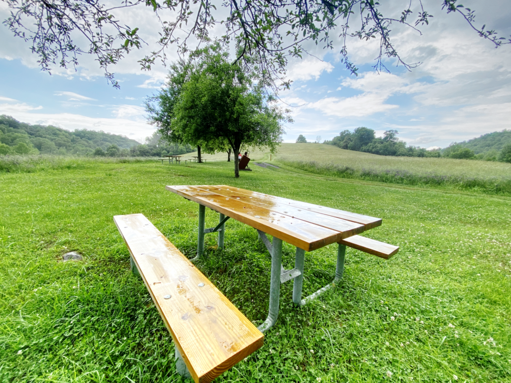
Sugar Hill Loop Trail is part of the larger Sugar Hill Trails System. On this hike, you’ll intersect with several other trails of varying difficulty. Along the loop trail, you’ll officially enter Clinch River State Park at the 900-foot mark after starting your journey clockwise. At .38 miles, you have the option of exploring the intersecting Hillside and Riverside trails. Continue on the loop path to reach a beautiful clearing at the 1.15-mile mark where you can enjoy a picnic lunch on one of the provided tables. There’s also another intersection with Riverside Trail here.
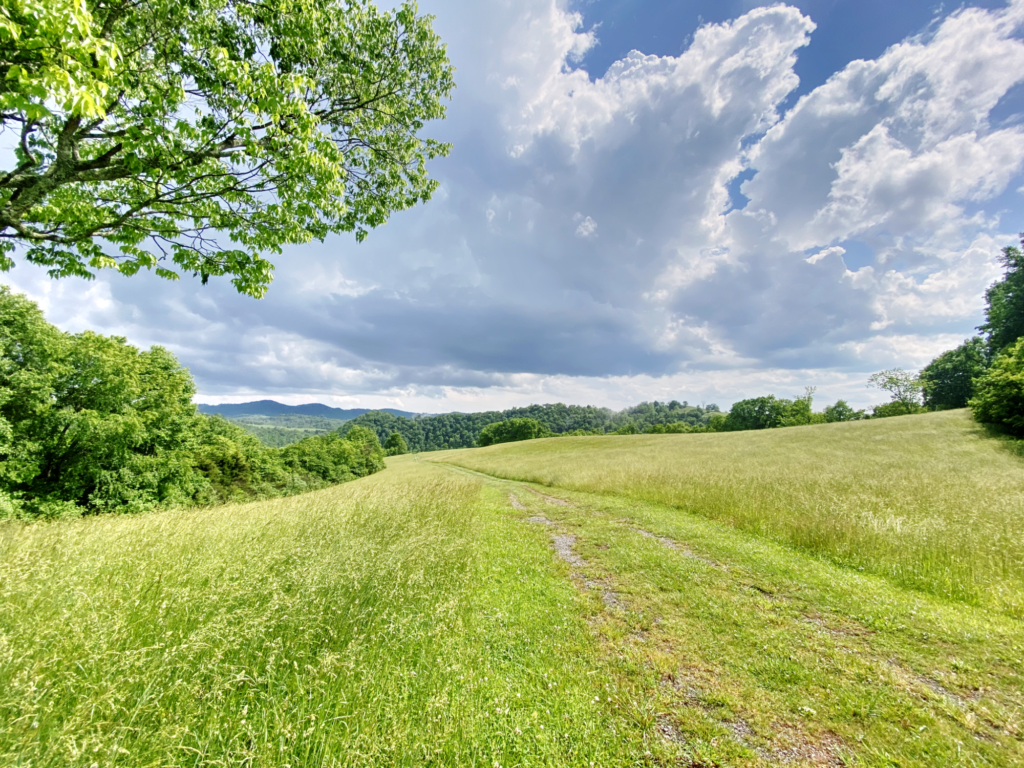
As you make your way up the scenic bald, you’ll pass intersections with Rock Bluff Trail (1.6 miles) and Hillside Trail (1.8 miles). This area is a wildflower lover’s paradise, so prepare to whip out your camera, which you might want to keep out of your pocket for possible wildlife encounters. We eyed three whitetail deer here, as well as many bird species. The panoramic views along this section of the loop trail are terrific and put SWVA on display in a great way.
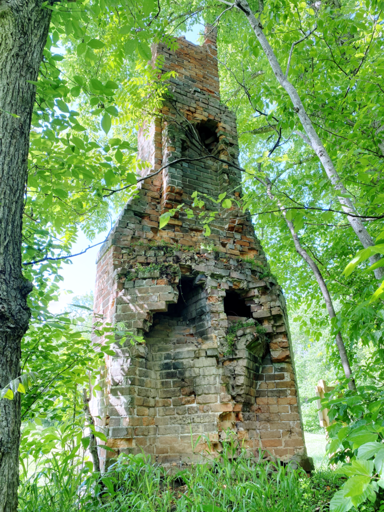
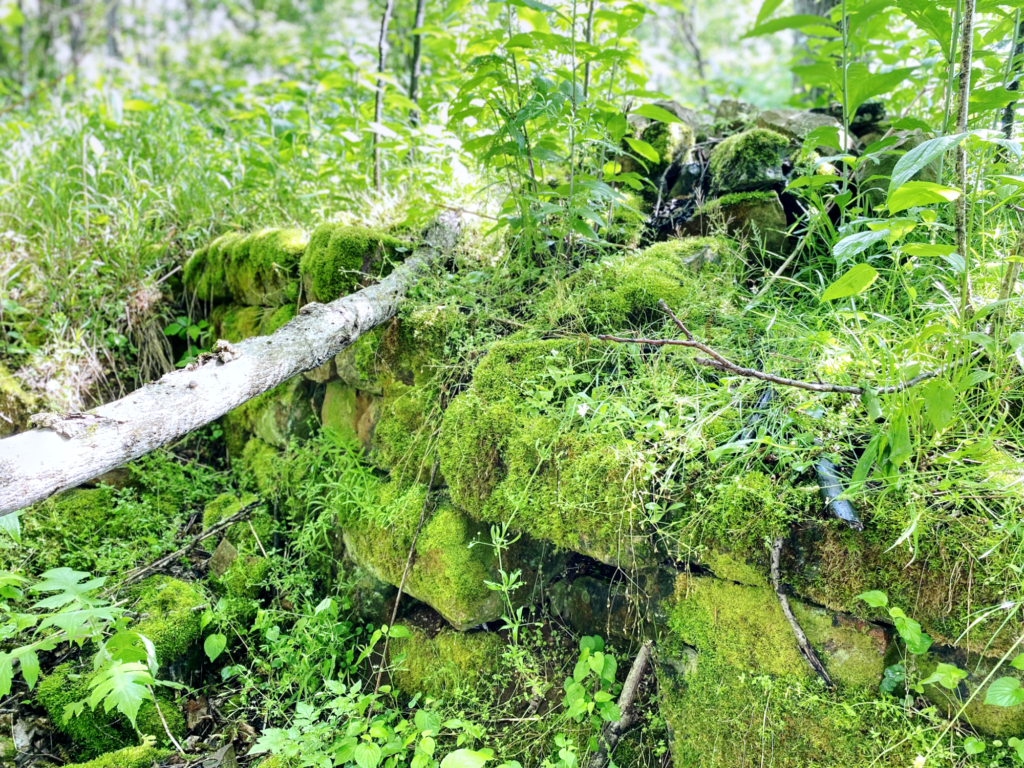
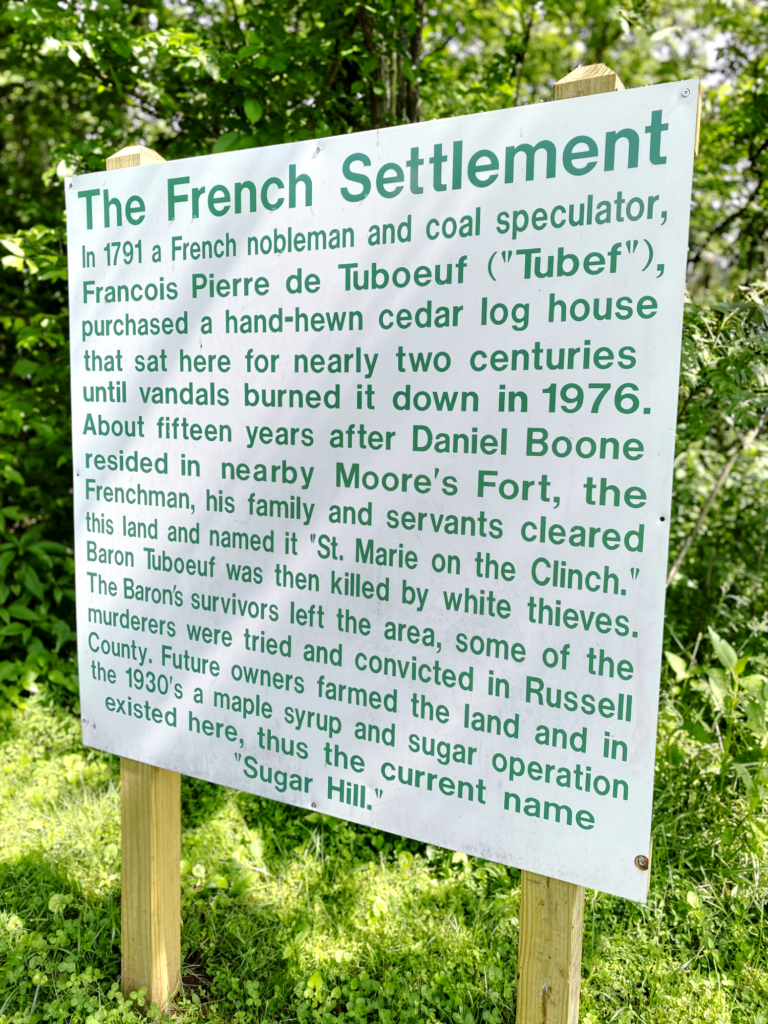
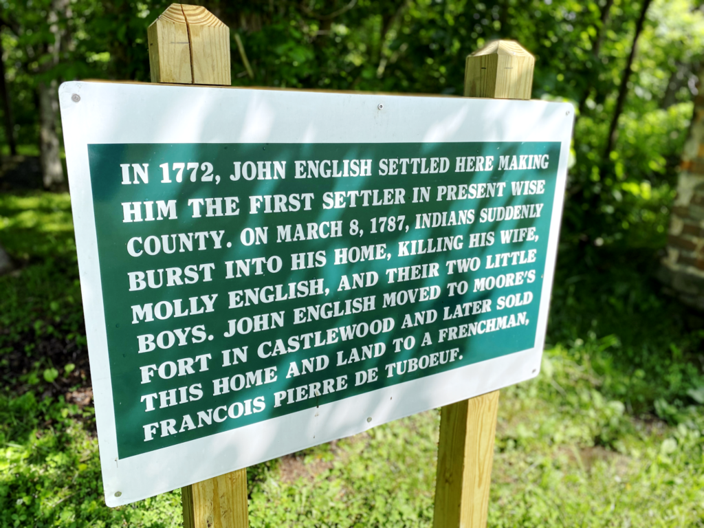
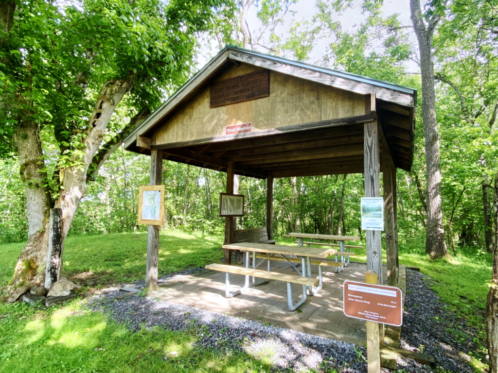
At the 2.1-mile mark, you have the option of exploring the Cliff Loop Trail, but you’ve also reached the historic 18th Century French settlement site. Here, examine the ruins of a cedar log house that stood for nearly two centuries. Most of the structure is lost to history, but the former home’s brick chimney remains in remarkably good condition, and remnants of the cabin’s foundation can also be viewed. Two markers near the chimney detail the site’s history. A single restroom is available at the site, and a trail shelter is situated nearby, as well. Very convenient.
After you’ve soaked up the history, continue along the loop trail, finally heading downhill on the last leg of the hike. This section of the trail can get fairly muddy and slick, so use caution. At the three-mile mark, glance to your left for a glimpse of the rail line that runs along part of the Clinch River. This section of the loop trail also boasts a number of educational tree markers, pointing out the American Beech, Black Walnut, Yellow Poplar and, appropriately, Sugar Maple species, among others.
For any family interested in lacing up the hiking boots for the first time, Sugar Hill Loop Trail deserves to be at or near the top of the list to start your trekking hobby off on the right foot. It has a little bit of everything!