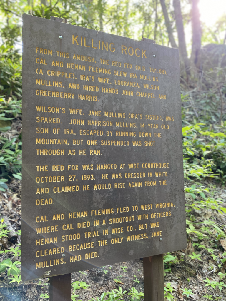
Red Fox Trail, a moderate trail with historic significance, takes its name from M.B. Taylor (a.k.a. “The Red Fox”), who was hanged following a massacre at the site in 1892 that left five dead. At this out-and-back’s destination point, you’ll reach what’s known today as Killing Rock, where an ambush resulted in the gruesome scene. While we rate this trail as moderately difficult, it’s on the low end of the moderate scale and not particularly challenging. Parking capacity at the trail head is limited (4-6 vehicles), and there are no restrooms. The trail is located on George Washington and Jefferson National Forest land and maintained by the U.S. Forest Service. The closest town is Pound, VA.
| Type | Difficulty | Distance | Time | Max Altitude | Altitude Gain | |
| Out and Back | Moderate | 2.5 miles | 85 minutes | 2,271 | 413 |
Trail Head Coordinates: 37°08’59.9″N 82°37’32.3″W
Destination Coordinates: 37°09’09.3″N 82°37’52.1″W
GIS Mapping Files: CSV GPX KMZ
What to Expect
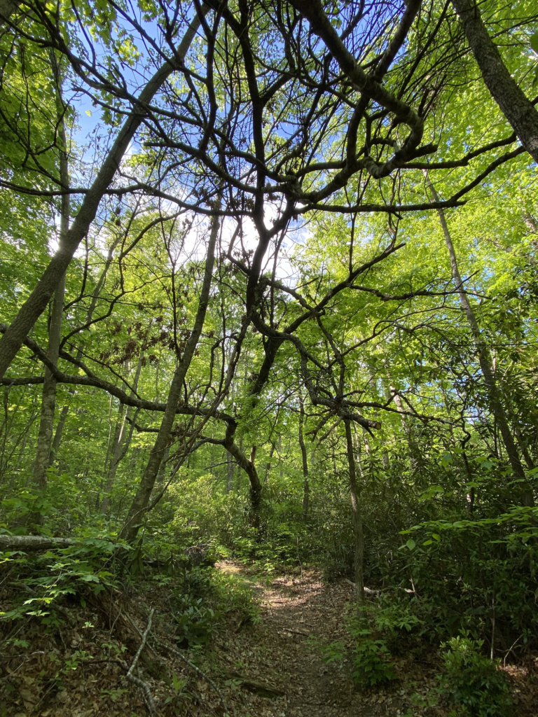
From the trail head, you will follow a flat gravel road for a short distance before ascending toward Killing Rock. This trail, located on Pine Mountain only three miles from the Town of Pound, is well-marked with signage and tree blazes. You won’t have trouble navigating your way to the destination. Red Fox Trail is open to hikers, bicyclists and horses. However, muddy sections of the trail are impassable to bicycles.
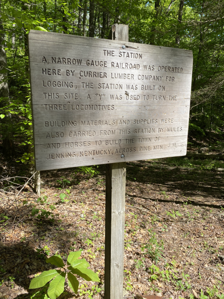
After following the gravel road for approximately 1,000 feet, trail signage directs you right-handed onto a wide foot path. When you reach the .40-mile mark, you’re greeted by an unexpected bit of history on your way to Killing Rock as you approach a flat where a narrow gauge railroad station once stood, operated by Currier Lumber Company. A nearby marker indicates building materials were carried from the station to build the nearby Town of Jenkins, KY, an eight-mile journey from the site.
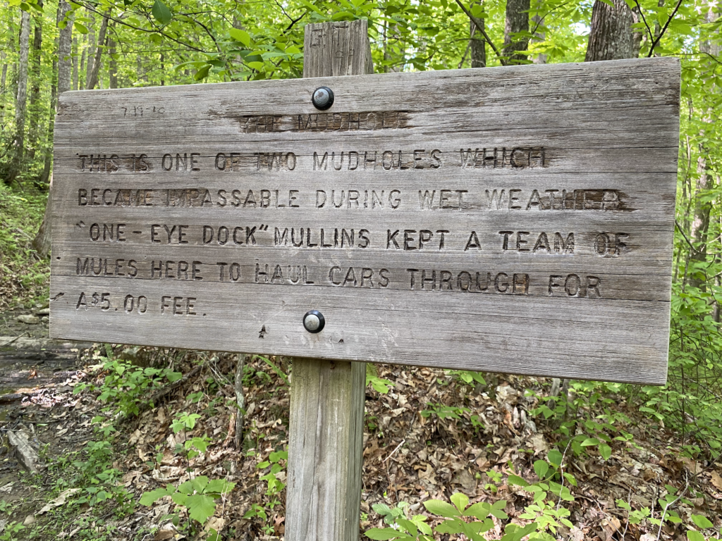
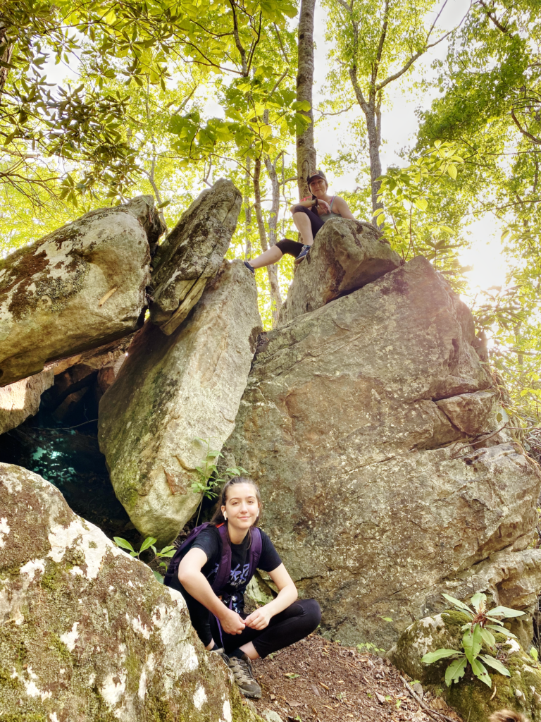
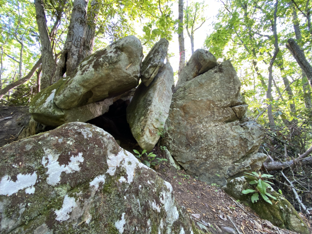
From the old station site, trail signage directs you right-handed again, this time onto a forested foot trail. This is a fun section of the trail to cross, but be mindful of the mud bog that could be challenging for younger children. From here, follow the densely-forested path all the way up to Killing Rock, which is reached at the 1.28-mile mark. A historical marker awaits you just below the rock, where you can learn more about “The Red Fox” and his accomplices.
While this trail offers no scenic overlooks or views of the surrounding mountainscape, it’s a quick hike that can be done in less than 90 minutes and is a worthwhile trek for its historical value alone.